Cultural trail ”Minnenas stig”
Here we will present our cultural trail, ”Minnenas stig” (Trail of memories), the different trail loops as well as texts and translations. Welcome back again soon!
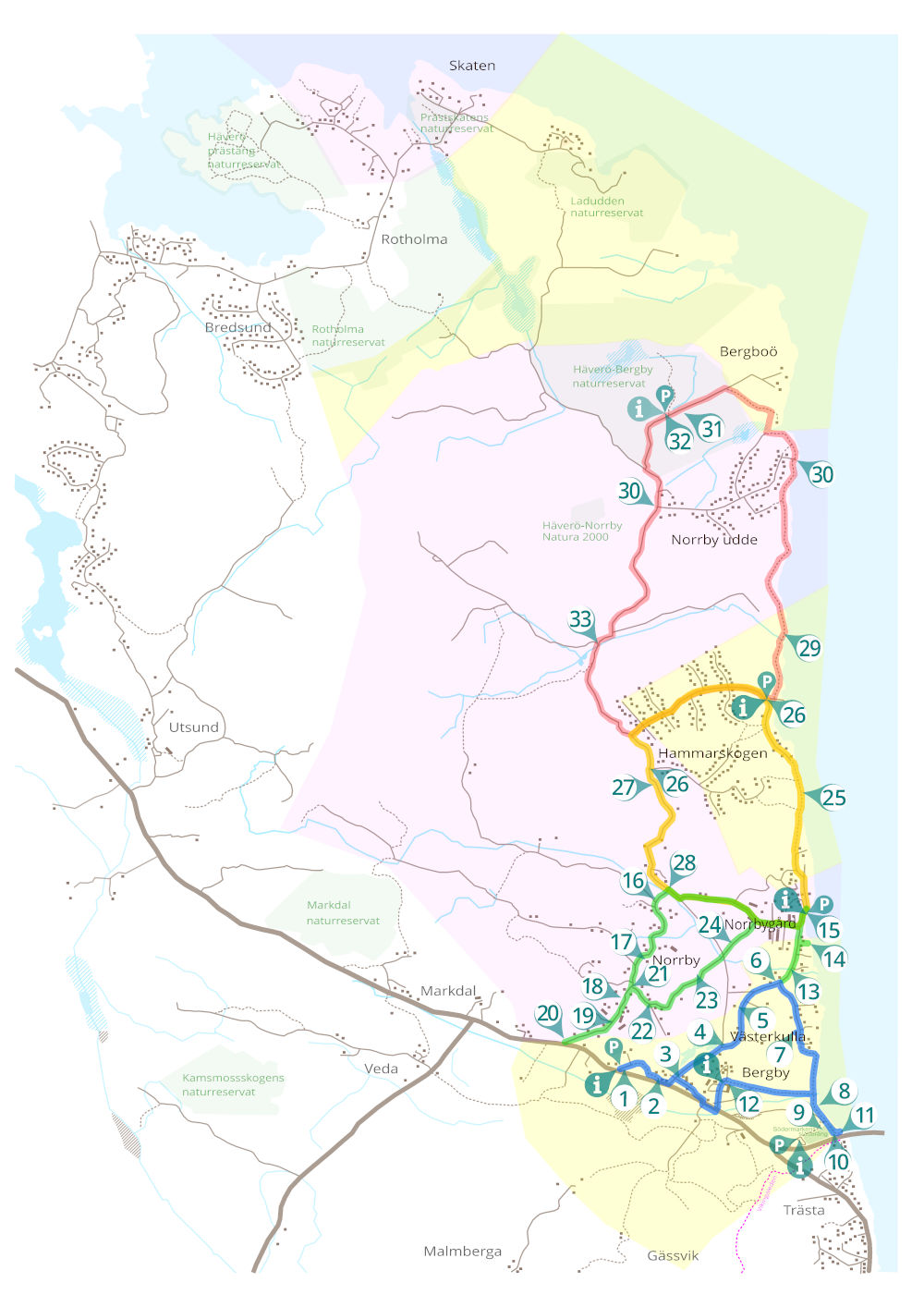
BERGBY-VÄSTERKULLA (Blue trail) ca 4,8 km
The blue trail is partly on an easier nature trail. Accessible for everyone on foot and by bike. Less suitable for strollers, walkers or wheelchairs.
- Bergby Skola (village school). Information board with map, parking lot.
- Bergby Handel (village shop)
- Västerkulla village
- Västerkulla farm
- Bergby mill
- A Roslagen farmhouse
- Bergby anti-aircraft battery
- Bergby beach
- Södermarken meadow
- Trästa bridge. Information board with map, parking lot. Connection to ”Vikingaleden” (St Olavs Waterway, or The viking trail).
- The boarder mark
- Bergby Gård. Information board with map, parking lot.
NORRBY (Green trail) ca 4,8 km
The green trail runs on roads. Accessible for everyone on foot and by bike, with stroller, walker or wheelchair.
- The water mill
- Bergby pier
- Norrbygård. Information board with map, parking lot.
- Byängen
- Mellangården
- Linbäcken (flax preparation site)
- The dairy cows
- Norrby crossroads
- Prästgårdsbacken (the rectory hill)
- Södergårdarna
- Ancient remains
- Electricity
HAMMARSSKOGEN (Yellow trail) ca 7 km
The yellow trail is mainly on roads. Accessible to everyone on foot as well as bicycles and strollers. Rollators and wheelchairs work with a little help.
- Oxberg
- Hammarskogen. Information board with map, parking lot.
- Kolbotten & Viktoriastugan (residues from charcoal production)
- The boatswain’s cottages
BERGBOÖ (Red trail) ca 13 km
The red trail mainly follows nature trails. Accessible to everyone on foot. Not suitable for bicycles, strollers, walkers or wheelchairs.
- Kvarnbacken (the mill hill)
- Norrby Udde
- The mines
- Häverö-Bergby nature reserve. (County Administrative Board sign) Information board with map, parking lot.
- The forestry