11. The boundary marking
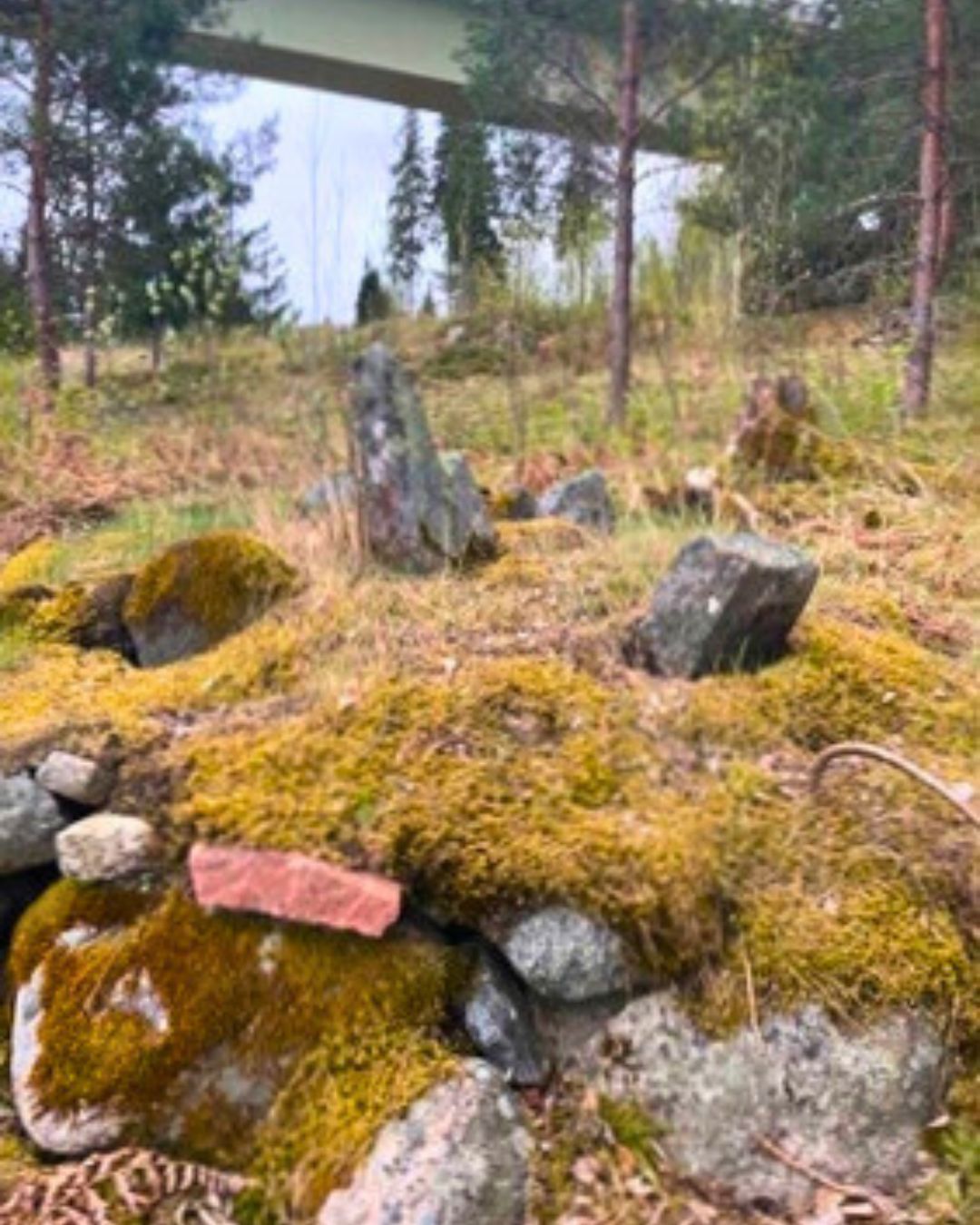
The boundary marking (or rough mark) called ’Ortalaviksrøret’ marks the old boundary between Bergby and Trästa villages. Since ancient times, there has been a need to mark the boundaries between different lands and villages. Already in the Upplandslagen 1296 it is stipulated that ” All villages shall be surrounded with merc and rough”. A merc is a boundary post, a rough is a cairn. The law explains how rough marks should be arranged: ” It is a rough, where five stones lie, one in the middle and four outside. Four stones or three may be called rough. No fewer stones may be called rough marks between villages.” The middle stone is called the heart stone and the four around it are called the cairn. Rough marks and boundary markings are carefully described, often with their own names, in parcel maps with associated cairn descriptions. The oldest parcel map in our area shows boundaries and rough marks in Bergby in 1755.
The Ortalaviksrøret has been mentioned since 1840 and is described as follows: “It was located on fairly level ground 21 cubits from the shore of Wäddö vik. The diameter of the cairn was 5 cubits and its greatest height in the east 1 cubit. ” The metric system was first adopted in 1878 in Sweden and 1 cubit corresponds to 59.38 cm. Due to the land elevation, the rough mark is now about 20 meters from the shore. There are about ten old rough marks around our villages, but the Ortalaviksrøret is the most easily accessible.
Not only were the village boundaries marked with rough marks. Even the boundaries between common land and between different homesteads were marked with small cairns or single stones. Today, iron studs on stones or metal pipes driven into the ground are used as boundary marks, e.g. by the Swedish Land Survey.
Download .pdf ↓
Extra material
Senast uppdaterat kl. 21:26, fredag 19 december 2025